I built a custom web app to test my MBCTD model on the 2025 LA wildfires. Here's a look at how it generalized to real-world disaster damage on the fly.
Back in January 2025, the Palisades and Eaton wildfires devastated parts of Los Angeles. Because rapid damage assessment matters so much for recovery efforts, I wanted to see if the MBCTD (Multi-Label Building Change Type Detection) model I've been building could accurately map the destruction.
From a machine learning perspective, the question was whether a model trained on standard building changes, like ordinary urban redevelopment, could generalize to the severe structural loss of a major wildfire.
Could it do it zero-shot, without any extra training?
The setup: on-the-fly inference
To test this, I threw together a prototype app using Solara and Leafmap. The idea was to stream high-resolution aerial imagery directly from Pictometry's WMTS feeds (provided by LA County), run the model, and see the results instantly.
The workflow is simple:
- Draw an area of interest over a neighborhood.
- The app fetches the pre-fire (2024) and post-fire (Jan 2025) imagery tiles.
- The imagery passes through the MBCTD model.
- It renders a damage mask directly onto the map.
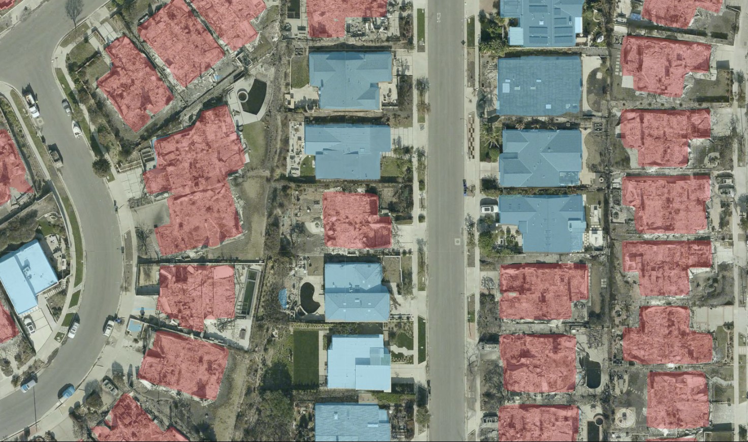
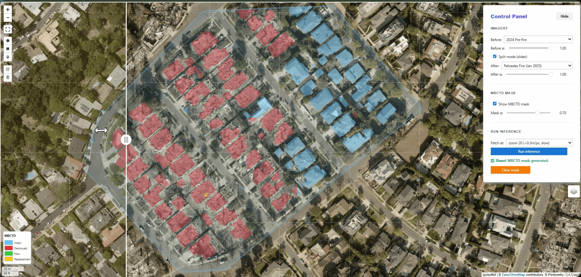 The Solara app running MBCTD inference over a selected area of interest. Blue means the building is intact; red means it’s destroyed.
The reality check: how did it do?
Without ground truth data, I couldn't compute formal IoU or F1 scores. I had to rely on visual evaluation.
Despite the massive domain shift from French cities to the scorched hills of California, the model identified most of the destroyed homes. I noticed a few false negatives and false positives, but the zero-shot performance held up surprisingly well.
I attribute this robustness to the FOTBCD dataset. Training on over 220,000 diverse image pairs forced the model to learn the actual visual semantics of structural destruction, rather than just overfitting to the local environment.
Why zero-shot matters
You don't always have to fine-tune a model for every new disaster type or geography. If the underlying training data is diverse enough, you can point a model at an unseen, out-of-distribution scenario like a California wildfire and still get useful results.
For disaster response teams, this means skipping the days of manual mapping or custom model training. They can generate damage assessments as soon as clear imagery is captured, helping route relief where it is needed much faster.
Interested in using MBCTD for your own commercial applications, monitoring platforms, or disaster response workflows? Contact me to chat about licensing.
- Dive into the MBCTD model: MBCTD Release Post
- Explore my training data: FOTBCD Dataset